Fuji Five Lakes · North shore of Lake Kawaguchi (by sightseeing bus)
Kawaguchi Asama Shrine
How to get there and what to see · facts checked 2026-10-24
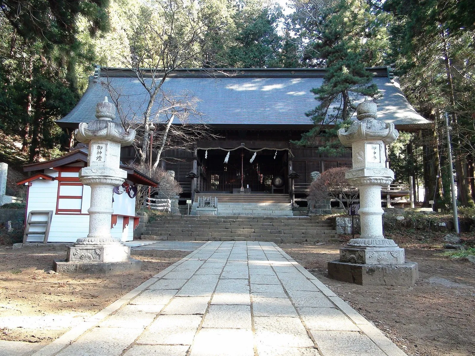
Photo: Sakaori (talk)・CC BY-SA 3.0
An old shrine founded to calm Mt. Fuji's eruptions. The quiet grounds hold the Seven Cedars, said to be 1,200 years old.
- Nearest station
- About 30 minutes from Kawaguchiko Station by sightseeing bus, then a 25-minute walk
- Hours
- 9:00-16:00 (per the tourism federation). The shrine itself says it has no wall or gate and can be visited at any time
- Admission
- The sources list no charge for the grounds
What to see
- Seven Cedars: a prefectural natural monument, each said to be 1,200 years old.
- Cedar avenue: many of the trees are about 800 years old, dating from the Kamakura period.
- Great torii gate: about 18 m high, it welcomes visitors at the entrance.
- Jomon site: the remains of a building made for rituals about 4,000 years ago.
- Chigo no Mai: a children's dance designated a national Important Intangible Folk Cultural Property.
Seasons
- The main festival is on 25 April, and a sacred dance festival is held in July.
History
It began in 865 when the court ordered a shrine built to calm Mt. Fuji's eruptions. Today it is one of the component sites of the Mt. Fuji World Heritage listing.
Getting there
About 30 minutes from Kawaguchiko Station on the Red Line sightseeing bus to "Kubota Itchiku Bijutsukan", then a 25-minute walk (per the tourism federation). It is far from the station, so allow plenty of time.
Address:1 Kawaguchi, Fujikawaguchiko, Yamanashi
Before you go
The "Heavenly Torii" (Mt. Fuji viewing spot) nearby is not run by this shrine.
Around Lake Kawaguchi
Tap a red pin to open that sight's page.
Nearby sights
- Kawaguchiko Museum of ArtAbout 25 minutes from Kawaguchiko Station by sightseeing bus
- Kawaguchiko Music Forest MuseumAbout 26 minutes from Kawaguchiko Station by retro bus
- Itchiku Kubota Art Museum20-30 minutes from Kawaguchiko Station by sightseeing bus, then a 5-minute walk
- Oishi ParkAbout 30 minutes from Kawaguchiko Station by sightseeing bus
← Fuji Five Lakes guide: trains from Tokyo
Sources
Hours, prices and history come from the official websites and public tourism pages listed here. They can change, so check the official site before you go.
- 河口浅間神社 公式サイト(トップ)(checked 2026-10-24)
- 同(境内の木々)(checked 2026-10-24)
- 同(境内の御案内)(checked 2026-10-24)
- 同(参拝・祈祷の御案内)(checked 2026-10-24)
- 富士河口湖町観光連盟(checked 2026-10-24)
Map data:© OpenStreetMap contributors